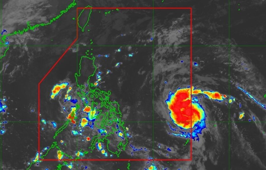
Typhoon Marce, the first storm in the Philippines in November, is forecasted to soon reach severe tropical storm and typhoon levels.

MANILA, Philippines — A tropical depression has developed into Tropical Storm Marce (international name Yinxing) after entering the Philippine area of responsibility early on Monday morning, November 4.
As of 4 a.m., the state weather bureau PAGASA reported that Marce was located 935 kilometers east of Eastern Visayas, with maximum sustained winds of 65 kilometers per hour (kph) near the center and gusts reaching up to 80 kph.
The storm is currently moving west-northwestward at a speed of 25 kph.
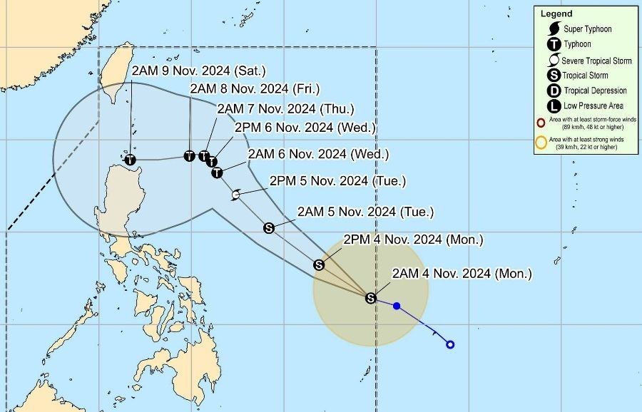
PAGASA predicts that Marce will gradually strengthen and may reach the severe tropical storm category by Tuesday morning or afternoon, November 5, with the possibility of developing into a typhoon by Tuesday evening or early Wednesday morning, November 6. The weather bureau cautions that rapid intensification is likely.
Potential impact, hazards
Currently, there are no Tropical Cyclone Wind Signals in effect, but Signal No. 1 may be issued for parts of Cagayan by tomorrow, Tuesday, November 5.
PAGASA states that the highest possible Wind Signal during the occurrence of Marce could reach Signal No. 4.
The movement of the storm may enhance the surge of the northeasterly wind flow, which is expected to bring rainfall to Extreme Northern Luzon and the eastern section of Luzon starting tomorrow or Tuesday.
Strong to gale-force gusts are anticipated today in Batanes, Cagayan including the Babuyan Islands, Isabela, Ilocos Norte, Aurora, and the northern part of Quezon.
In addition, rough seas with wave heights of up to 3.0 meters are forecasted for the seaboards of Batanes and Ilocos Norte. Small boat operators are advised not to venture out to sea in these areas.
Uncertain forecast track

PAGASA has stated that there is significant uncertainty regarding the storm’s path following Wednesday afternoon, presenting two possible scenarios:
- Marce may either shift more westward toward Extreme Northern Luzon or mainland Luzon, or
- It could move unpredictably over the Philippine Sea to the east of Extreme Northern Luzon.
The possible landfall area may extend from the Babuyan Islands to the Isabela region.

